Friday, March 20, 2015

Chilly Northumberland Spring

Having spent so many recent weekends having fun in North Wales, it was high time to reacquaint myself with the big skies and spreading shores of Northumberland. This was also to be the first camping trip of the year. My hopes for mild temperatures were dashed when I saw the forecast gentle easterlies and their associated bitter chill.

We arrived at the Springhill Farm campsite just after dark on Friday evening. From the camping field we could see the lighthouses of Longstone and the Inner Farne, and to the north was Bamburgh Castle floodlit in all its grandeur. We hurriedly put up our tents before heading to the pub to keep warm.


Embedded image permalink
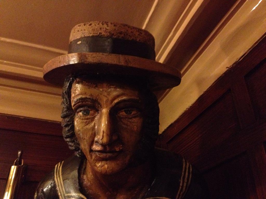
On the walk to The Old Ship Inn at Seahouses the streets were deserted. It was a pleasant surprise to find the pub packed with locals. There is always a wide selection of fine ales in this characteristic hostelry and the atmosphere on this particular Friday evening was lively.

Embedded image permalink
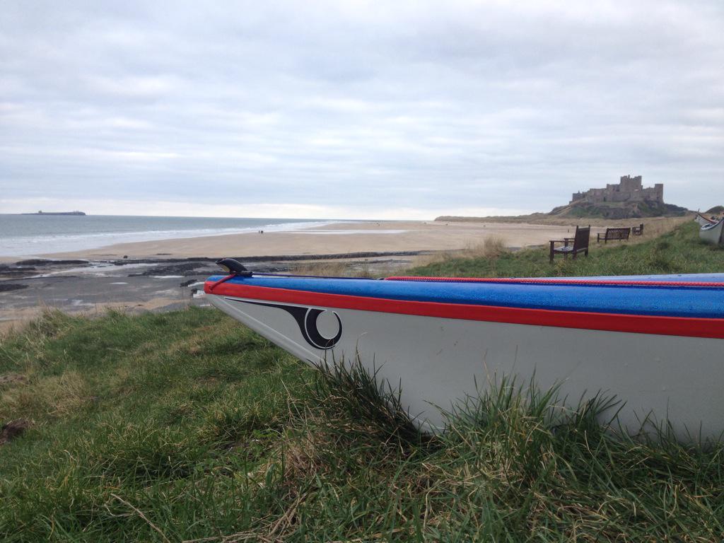
On Saturday Morning we assembled on Bamburgh Beach in readiness for a trip out to The Farne Islands. We set off from 'stag rocks' through small surf and headed for the tiny rocky islet called Megstone.

Megstone was crowded with Shags and inquisitive seals which followed us part of the way to our next destination of Staple Island and Brownsman. Reaching further out to sea we found deeper swell and rougher seas on the way out to Longstone and its historic lighthouse. This group of islands is where the story of Grace Darling is secured in maritime history.

After lunch on Longstone, we returned along the dark edges of Brownsman and Staple Island. Huge flocks of guillemots and razorbills were circling the cliffs and sea stacks known as 'The Pinnacles'. The swirling movement of the birds combined with the lively swell made for a mesmerising journey back to Bamburgh via Inner Farne.

Sunday dawned with lighter winds but greater movement in the sea. The increased swell would prove to be a challenge.  We set off from the sheltered beach next to the harbour at Beadnell. The Castle ruins at Dunstanborough stand high upon a tall headland of Whin Sill to the south. Beyond lies the tiny harbour of Craster. All along this coast there are rocky reefs. The imposing swell trips upon the reefs forming isolated breaking waves known as 'boomers'. Their presence may drain the mouth of saliva and increase the heart rate, but they are easily avoided. As we passed Football Hole and Low Newton we found that the noise of the waves crashing on the Dunstanborough Cliffs made for a nerve wracking and claustrophobic approach through the last couple of reefs to the tiny entrance of Craster harbour.


Monday, February 09, 2015

Sunshine, Snow and Ice, Snowdonia at its best.

Its been over a year since I enjoyed a long day in the hills. With a divine forecast and the mountains painted wintry white I was destined for a day on the Snowdon Horseshoe. Others had spied the excellent conditions and the car park at Pen-y-Pass was almost full by 9am.

The path to the foot of Crib Goch was tricky from the start with compacted snow that had thawed the re-frozen. It was difficult to "look well to each step", because the view along the ridges and down the pass was so intriguing with the swirling mist and changing light.

In places the snow made the going on the ridge a little easier than usual. In others it made things damn scary! We took our time but eventually left the excitement of Crib Goch and Crib y Ddysgl behind us pausing briefly on Carnedd Ugain to take in the views.

We wanted to have lunch on the summit of Snowdon but as we peered across, we wondered if there would be enough room for us amongst all of the others who had the same idea. The carnival atmosphere was reinforced by a bunch of lads celebrating their arrival with bottles of ale.

The descent of the steep southern slopes required careful attention. The warm sunshine was rapidly melting the deep snow covering the gravelly path. The the coast to the west had been largely obscured by low cloud and mist. However, from the summit of Lliwedd, there was beautiful view over Porthmadog and the Dwyryd Estuary to the south.

We followed the final ridge path and left the sunshine behind us with a challenging descent picking our way across snowy ledges and small icy gullies towards the chilly shores of Llyn Llydaw. A broad path lead the way back to Pen-y-Pass. Anti-climax gave way to an overwhelming awareness of sore feet. A great day out!

Sunday, February 08, 2015

Cross-country Skiing in the Peak District

Around Manchester the snow came down in fits and starts. At one point the airport was closed until both runways could be cleared of snow.

Trevor and I had planned to do some cross-country skiing near to Mam Tor in the Peak District. At first our plans were in doubt because of mild overnight temperatures. However, it was the freshening northerly winds and roads blocked with drifting snow that provided us with the first challenge.

We eventually parked the car near Mam Tor and set off across the the rolling hills so the South.

Stiles, gates and low walls were often completely buried in snow drifts. This made our journey much easier than expected.

The wind was getting strong enough to take your breath away and regularly whipping up blinding blasts of spindrift. It was whilst we were sheltering beside a wall that we spotted several people with mountain bikes. We said 'hello!' and had a brief chat. They seemed in good spirits but must have been having a very difficult day.

Sunday, January 18, 2015

Short Days and Long Shadows

It can be difficult to keep motivated and active through the gloomy weather and short days of mid Winter. Illness had kept me largely indoors through most of the festive period so it was great to get out for a long easy walk with some new friends.

We set out from Bakewell in the Peak District and headed along the Monsal Trail aiming initially for Monsal Head.  Once there, we took a few minutes to take in the spectacular view over the deep valley cut by the River Wye.

We descended to the chilly depths of the Wye valley and made our way along the riverside paths to Lees Bottom. We soon warmed up again with a steep ascent through the woods and out across gently rolling pastures to the village of Sheldon.

Just south of the village lie the historical ruins of Magpie Mine; a lead mine that was worked until the 1950s. It is one of the more well-known lead mines in the Peak District. The Magpie Mine site is now cared for by the Peak District Mines Historical Society which exists to preserve these important industrial heritage sites.

Finally with fading light and a distinct chill on the breeze, we strolled our way south-west across  open farmland, to the pretty village of Over Haddon. Once through the village we made our final descent to complete our circle, and return to Bakewell for a well earned pint and platefuls of hot pub grub.

I'd like to thank my new friends from the Yomping Mancs for their company and for organising this eye-opening walk.


Saturday, December 06, 2014

Early Winter Sun

As the year enters its final month we are met with a distinctive damp chill. The woody aroma of damp leaves lingers beside the hedgerows as the first of the day's wintry sunshine weakens last night's frosty grip.

Whilst there are plenty of hawthorn berries left the birds will be fine, but I'm hoping for one of those long cold snowy winters. Its good to see that the bird tables and feeders are getting stocked up keeping our little feathered friends well fed.

Last week, out on the coast the skies were grey and moody. For the most part the days on the sea felt a little gloomy and it was too cold for long relaxing lunch breaks.

The reward at the end of a chilly day was the sunset. Orange and golden shafts of light slicing through through gaps in the blue-grey sky blanket. Winter is coming.


Monday, November 17, 2014

The Pleasures of the Lleyn Peninsula

The unsettled Autumnal weather relented and offered up a magical day. At this time of year, the sun hangs low in the sky casting long shadows with piercing golden light.

The surf at Aberdaron was easy enough but the swell and choppy seas at Pen-y-Cil was a little more challenging. As we made our way out West, the waters of Bardsey sound began to smooth over. This allowed for a more sociable and relaxed mood amongst the group.

Once sheltered from the south easterly wind, we found easy paddling on the north coast but every now and then, there would be huge powerful swell surging along the cliffs. This made the enticing rock gardens all but out of bounds.

Eventually, we found a small cobbly beach at Porth Orion. A low reef at its entrance gave a degree of protection so we landed for a late and relaxed lunch break.

During the final 3 kilometres we explored several rocky coves as we approached Porth Oer. At the final headland, a huge powerful wave reared up behind us then smashed into the coves where we had just been rock-hopping.

The sea had demonstrated its power to us but on this occasion, let us be. This had been an exceptional and thoroughly enjoyable day of sea kayaking on a stretch of coastline that I should visit more often.


Tuesday, October 28, 2014

Snowdonia Marathon Eryri

Back in July I quietly embarked upon a training schedule. I kept my regular Tuesday and Thursday  running activities whilst adding a longer run into the mix. Each week this longer run would gradually become longer and more challenging occasionally adding in some hill training.

Doing laps of Llandudno's Marina Drive became great preparation (and education) ahead of the toughest marathon in Europe. Marina Drive runs along the cliffs of the Great Orme; a huge limestone headland that towers more than 200 metres over the Irish Sea. One lap of the Great Orme is around 5 and a third miles with a climb of 120 metres.

The final training run was a gruelling four laps. This left me with a crippling injury to my right knee at only three weeks before the marathon. There was a real possibility that after all the training I might not be able to take part in the marathon.

After a week of little recovery I went to see a physiotherapist. I was half expecting to be told that I would not be fit for the marathon. To my surprise, I was told quite the opposite. Although painful, the injury is quite common to long distance runners and easily rectified with a good dose of massage and carefully targeted exercises and stretches.

So, on the day, I stuck to my plan and started at a relaxed and steady pace. Along with my work colleague Tina, I was enjoying the running, the scenery and the occasion. My name was printed just above my race number and it gave me an amazing morale boost to hear spectators call out, "Come on Jim!"

Photo: Claire Bishop
The first climb up to Pen-y-Pass was straight forward. The second climb was more difficult and I resorted to walking when I found it difficult to overtake those who were walking. By the time I reached the village of Waunfawr and the final climb, I began to feel a little pain in my injured right knee. Once again I (along with most others) resorted to walking. This preserved my energy and protected the knee, but the downside was it allowed me to get cold. Stiffness and cramp began to set in. It took a great effort to get going again but the last mile and a half was all down hill. The steep descent was painful but short lived and 5 hours and 19 minutes after crossing the start line I reached the finish. It was over. I'd done it... and now I could stop running.

However, the marathon is not quite over. At the time of writing I'm still hobbling around on stiff legs with a sore right knee and a troublesome left Achilles. The question is, as the aches and pains melt away, how long will it take for me to consider doing something like this again?

Tuesday, September 16, 2014

Winding Back

Over the last few days we re-traced our route to Sermiligaaq visiting our previous camps on the islands of Storø and Gruse. With time in hand we could explore the remains of old Eskimo settlements and hike up onto the high ridges to take in the expansive views.


Soon after we entered the network of channels that lead from Sermiligaaq to Tasiilaq we stopped to explore the abandoned US air base known as Bluie East 2.


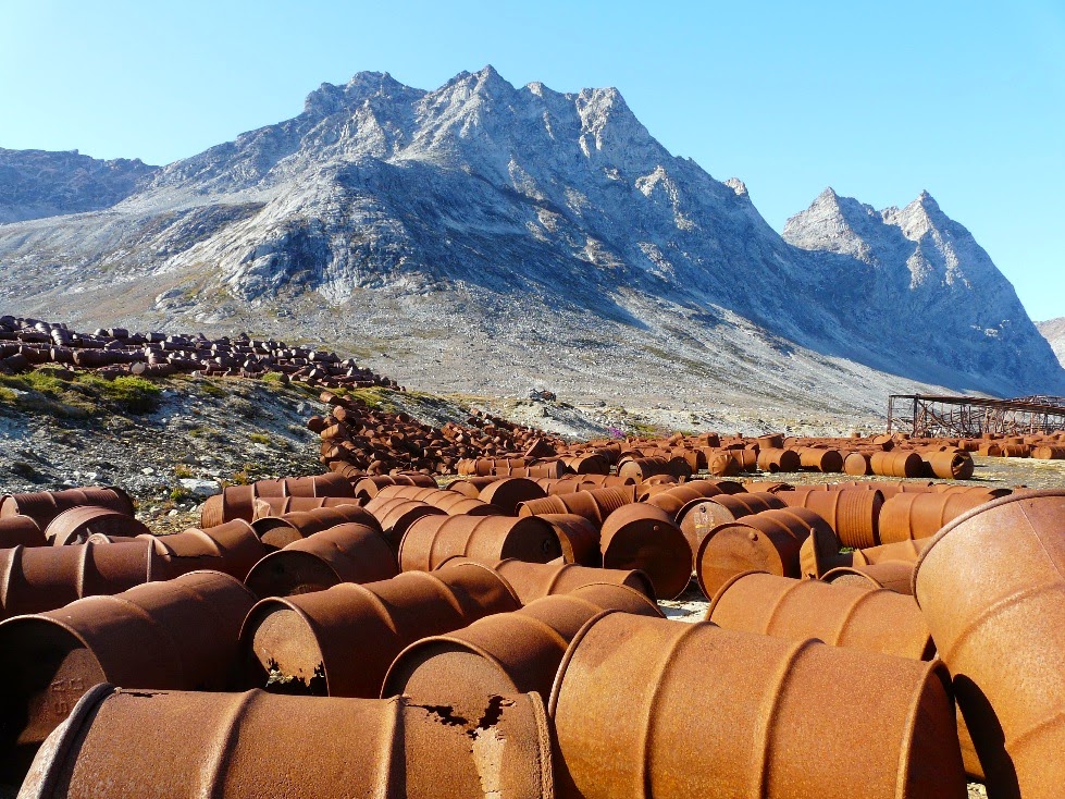
Bluie East 2 was hurriedly abandoned in the early 1950s. The local hunting communities made good use of the furniture and fuel that was left behind. Some of the truck engines remain in use to this day on fishing boats. The trucks, mangled hangar and some 100,000 oil drums make up a bizarre rusting wasteland that stands as a decaying reminder of the 'Cold War'. A blot in an otherwise pristine sub-Arctic wilderness.

A forecast of poor weather combined with news of a volcanic eruption prompted us to make a dash for Tasiilaq in order to wind things up and sort out our kit before strong winds and heavy rain would make this task a great effort.


It was a bit of an anti climax to return early but the underlying memory is of an expedition to a majestic coastline with such scale that I could not have imagined. The glaciers, the cliffs, the bergs and the Northern Lights were all so much beyond what my dreams could conjure up. 


As for Lake Fjord and the Watkins memorial, they will be there for another time and another adventure... Finally, I'd like to pass on my thanks to Martin Rickard at Sea Kayak Adventures for his impeccable guidance and  logistics arrangements, Clif Bar & Company for keeping us all in healthy & nutritious snacks, Lyon Equipment for support with Ortlieb dry bags and Trek 'n Eat expedition meals, Mitchell Blades for my excellent 4-piece Bombora paddles and finally to Peak UK and P&H Custom Sea Kayaks for their continued support.

Monday, September 15, 2014

Waterfall Valley & Glacier de France

The combination of sheltered waters and sunny weather made for almost Mediterranean conditions in Kangertittivatsiaq Fjord. It it baffling to feel too hot whilst paddling amongst ice. 


We finished the day two thirds of the way up the fjord on a beach with flat rocks that were warm from the day's sunshine. Between preparing food and pitching our tents we spent an hour or so sunbathing. 


To add to the paradise feel of our camp there was a raging river cascading over ledges and sliding over smooth slabs. As paddlers, we spent a while discussing the best white water lines down there impossible rapids and drops.


Before the sun went down behind the northern end of the fjord we followed the river further up the valley and wondered when people were last here.

When morning came we paddled for almost three hours towards the calving face of Glacier de France. The scale of this landscape was difficult to comprehend. I gazed beyond the fragile ice cliff and across the surface of the glacier stretching, twisting and curving for mile upon mile towards the mountains in the hazy distance. The most distant mountains were well off our map and north of the Artcic Circle.

This place was peaceful and quiet apart from the 'snap crackle and pop' from the brash. As the strong morning sun warms up small pieces of ice, tiny pressurised air bubbles burst as the surfaces melt. The fizzing and popping sound is amazing. Like paddling through a giant bowl of ‘Rice Crispies’. The ice kept us buzy as we turned to paddle south and continue our journey. From now onwards we would be working our way back towards Sermiligaaq and eventually Tasiilaq.

Thursday, September 11, 2014

Northern Lights

We found a great place to camp less than 2 hours paddling east from our 'retreat beach'. There was fresh water, plenty of space for tents and an excellent view. We had landed earlier than normal so there was plenty of time to relax and enjoy our surroundings. Two brave souls even took to the icy waters for a spot of Arctic skinny dipping. Brrrr!

I took a dim view of the aquatic daredevilry and went to bed early as I would need to be up at 1am for my 'bearwatch' shift. As soon as I got up I was surprised as to how dark it seemed. In mid August the nights get progressively darker at an alarming rate.

I stood on a rocky knoll and did a sweep of the nearby shore with the main beam of my headtorch. I must have been feeling a little on edge because I nearly jumped out of my skin when my torch picked out a particularly pale (bear-shaped) boulder on the beach. I put on my stove to make a cup of hot chocolate to settle my nerves. It was then that I noticed a pale green stripe gently moving across the dark blue sky. It grew into a collection of broad shafts of light that waved and curled like a curtain caught in a breeze. I had been staring long enough for the water on my stove to boil over. Thankfully there were no bears sneaking around camp.

In the Morning all we could talk about was the fantastic light show but it was time to head North-West for our consolation prize; a couple of days exploring Kangertittivatsiaq fjord and the calving face of Glacier de France.

Wednesday, September 10, 2014

Hell Corner


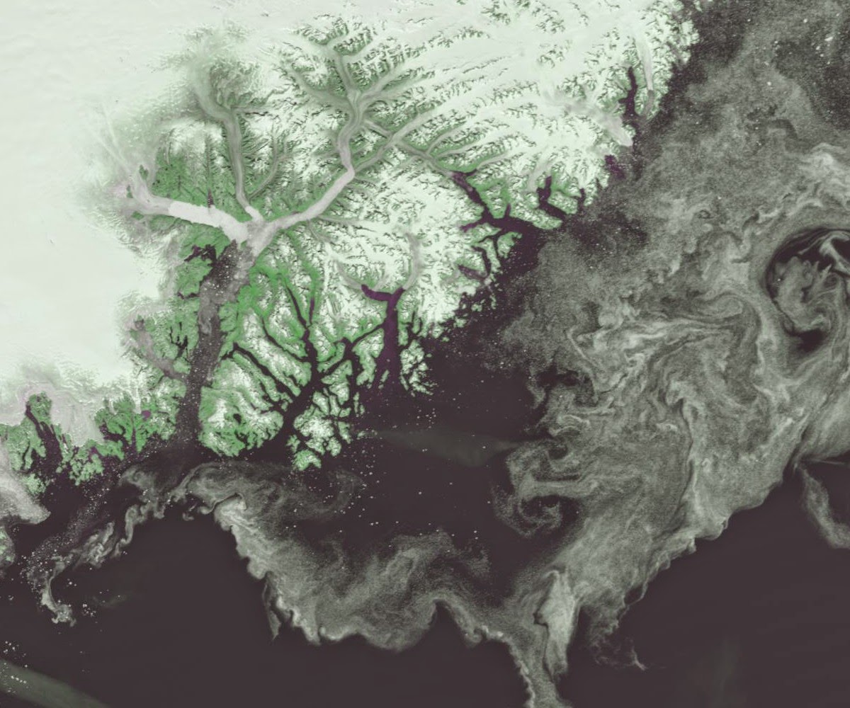
The team rose early soon after the sun rose into the blue morning sky. The sea was calmer and the weather forecast favourable. The northern tip of Storø is around 10 kilometres across a wide channel from the beginning of a 30 kilometre stretch of coastline dubbed 'Hell Corner' by Watkins' 1930s expeditions.

The closer we got the greater the swell became. As we approached the first major headland the waters became choppier than we had seen on this trip. Several huge bergs that were surging in the swell gave us only limited room to get through, or around.

http://ocean.dmi.dk/arctic/ammassalik.uk.php
Normally, there would also be bands of pack ice sitting just offshore. The presence of pack ice serves as a slowly drifting breakwater and dampens off much of the energy from the swell. It is also possible to land on these flat fragments of frozen ocean to rest on long passages. On this occasion the pack ice was gone. Only huge bergs remained leaving our route around 'Hell Corner' exposed to the undiluted power of the Denmark Strait.

There group had gone a bit quiet. There was none of the usual chatty banter. A decision needed to be made and agreed upon so we rafted up.  Even holding the kayaks together was tricky as they banged together in the surging choppy sea.  With a further 30 kilometres of committing paddling to go, there was insufficient confidence to go ahead, especially as we had only a vague forecast for the return.  Reluctantly, we decided to retreat to a beach that we had passed some 40 minutes earlier.

We landed through surf onto a broad pebbly beach in a bay that was littered ice fragments. We took our time to eat, rest and recuperate. If we were to abandon our plans to reach Tugtilik, we would need to identify a new objective. In the meantime, somewhere to camp would be good too...